



Mapthread
Transform your travel stories into interactive map experiences. Upload GPX files, place markers, watch the map follow as readers scroll.

Use with caution
Mapthread works, but test it on a staging site before relying on it in 2026. It runs on 10+ sites and was last updated 4 months ago, and scores 51/100 on our health check.
- Small user base (10+ active installs)
- Very few reviews so far
How does it stack up?
Side-by-side on installs, updates, ratings & support


Daily downloads
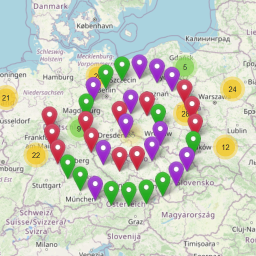
Download spikes usually follow a new release — each site that auto-updates counts as a download.
Rankings
Where Mapthread stands todayWordPress.org search rankings
Live position in the plugin search, top 100| Keyword | Position |
|---|---|
| GPX | #22 |
| hiking | #8 |
| map | >100 |
| route | >100 |
| travel | >100 |
Version adoption
Share of active sites per release.
About Mapthread
From the official readme · v1.6.2Description
Mapthread brings your adventures to life with interactive, auto-following maps.
Perfect for travel bloggers, hiking enthusiasts, and anyone who wants to tell location-based stories that engage readers.
Storytelling
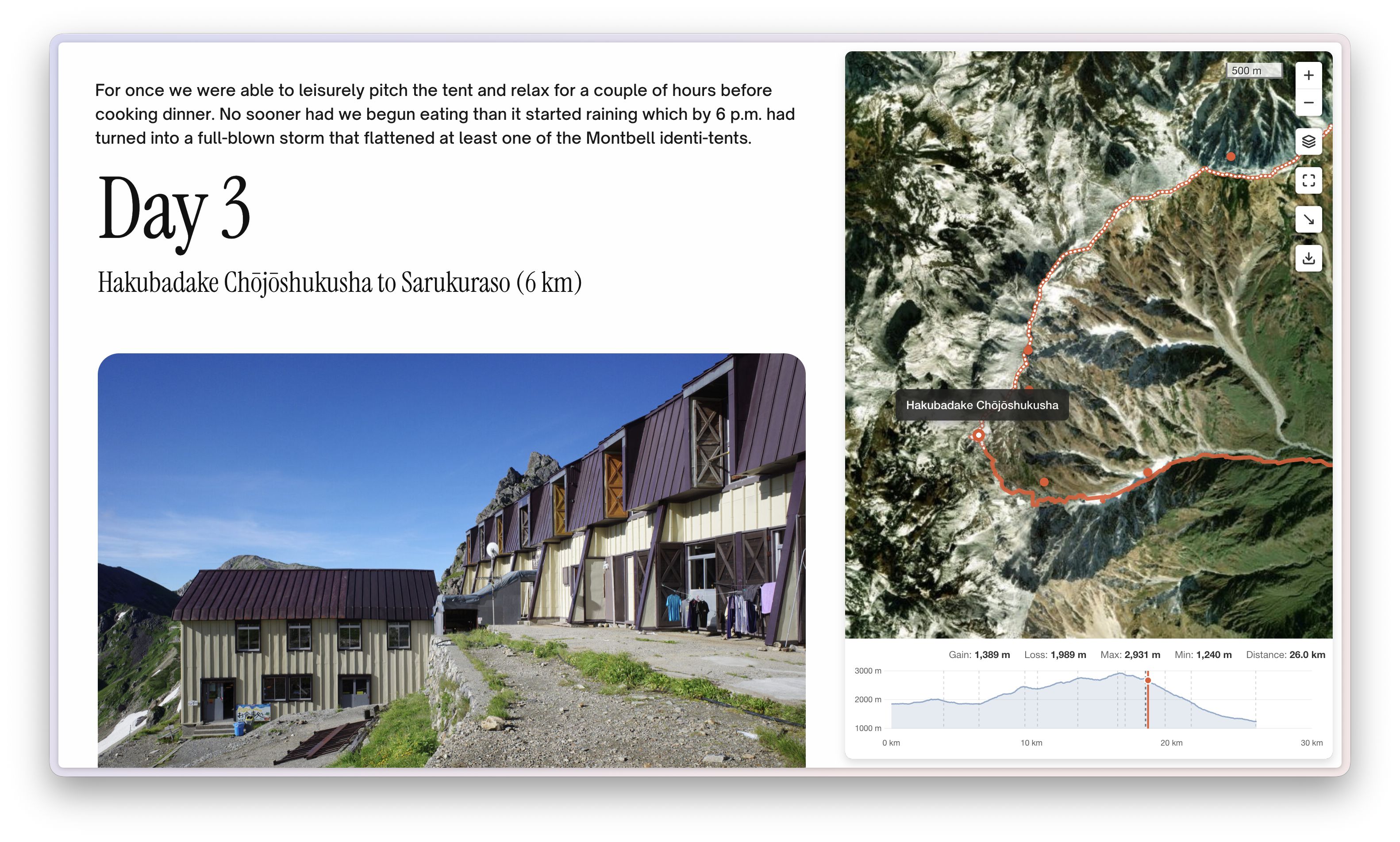
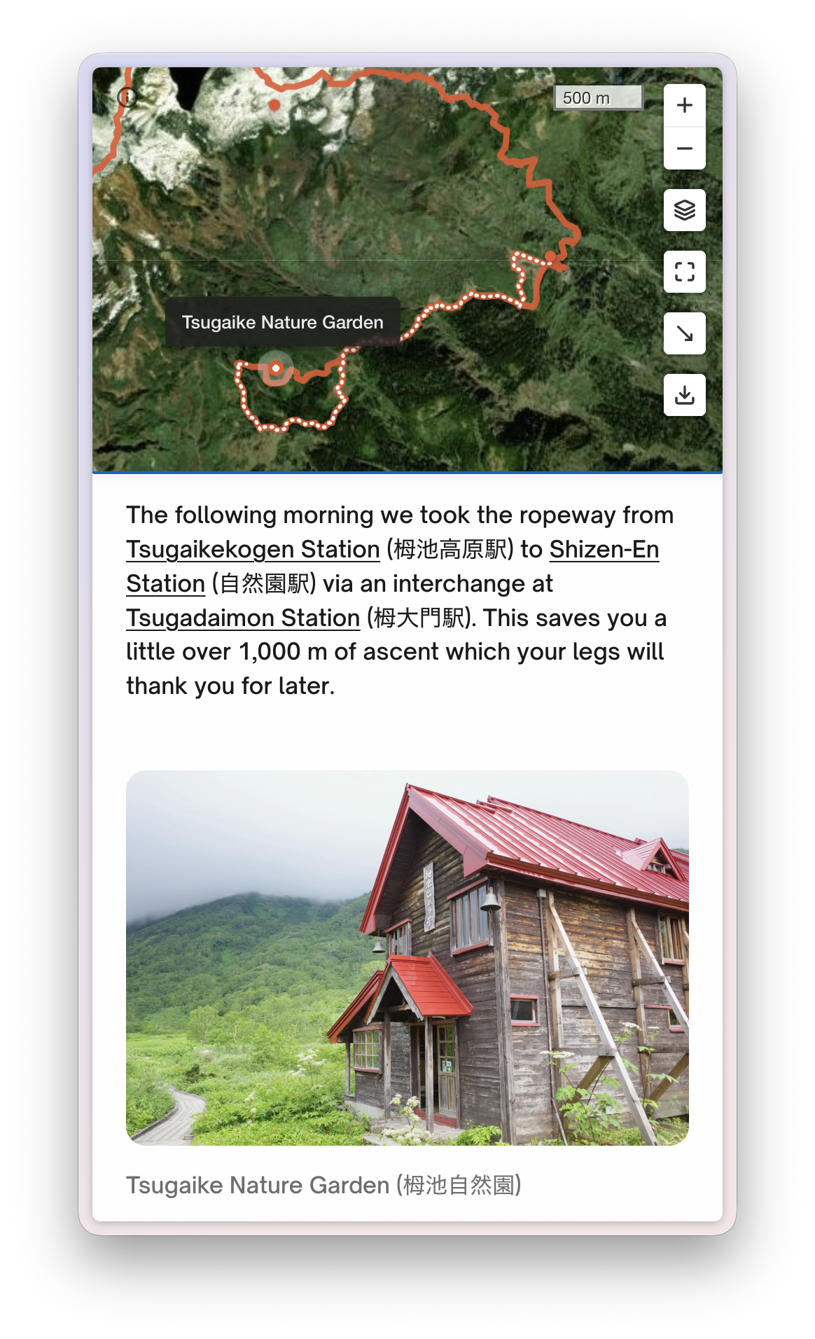
- Map automatically follows your narrative as readers scroll
- Pauses when readers explore the map themselves, resumes when they scroll on
- Click any marker to jump to that part of the story text
Maps
- Upload a GPX file from any hiking, cycling, or fitness app
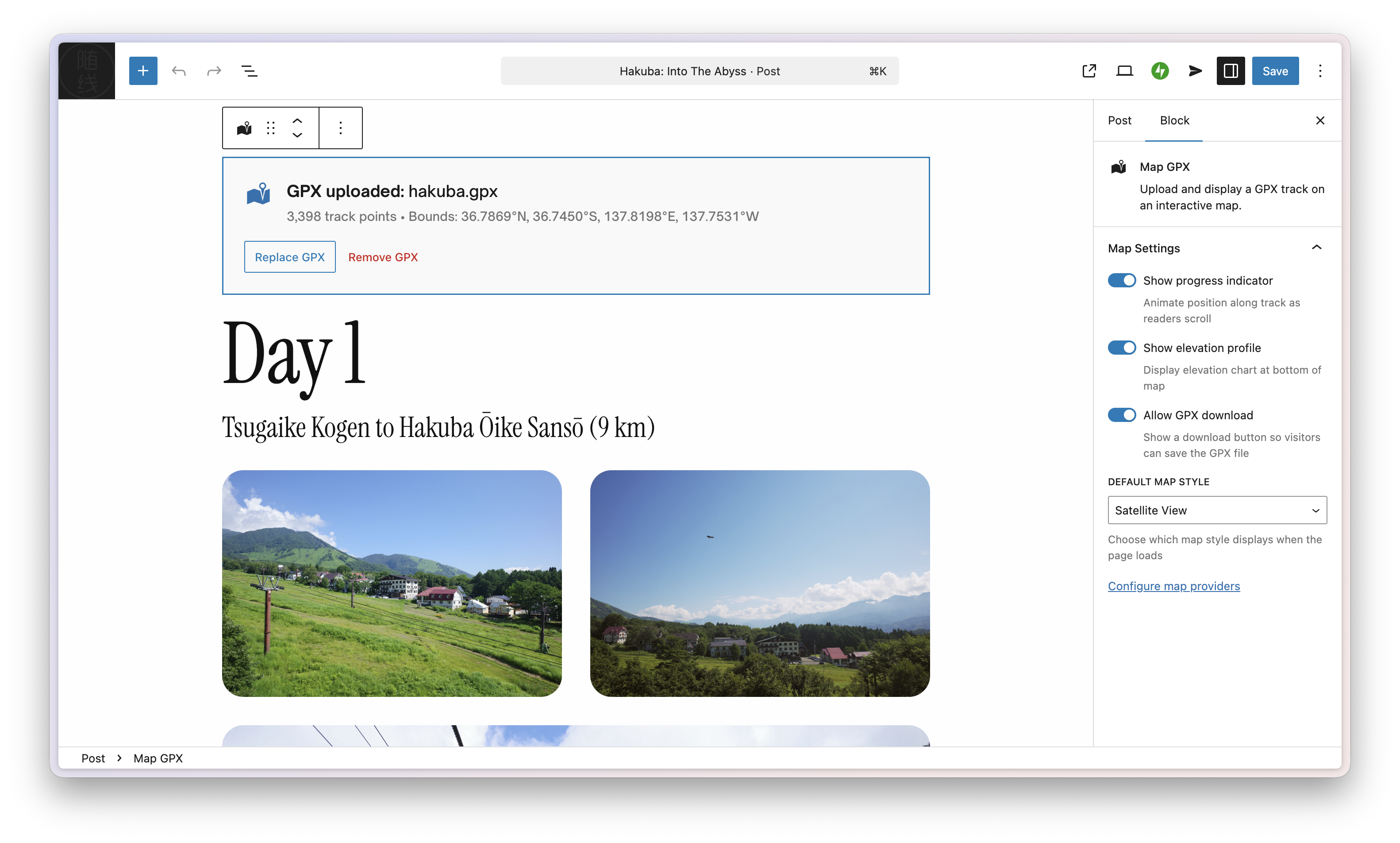
- Elevation profile with distance and gain/loss stats
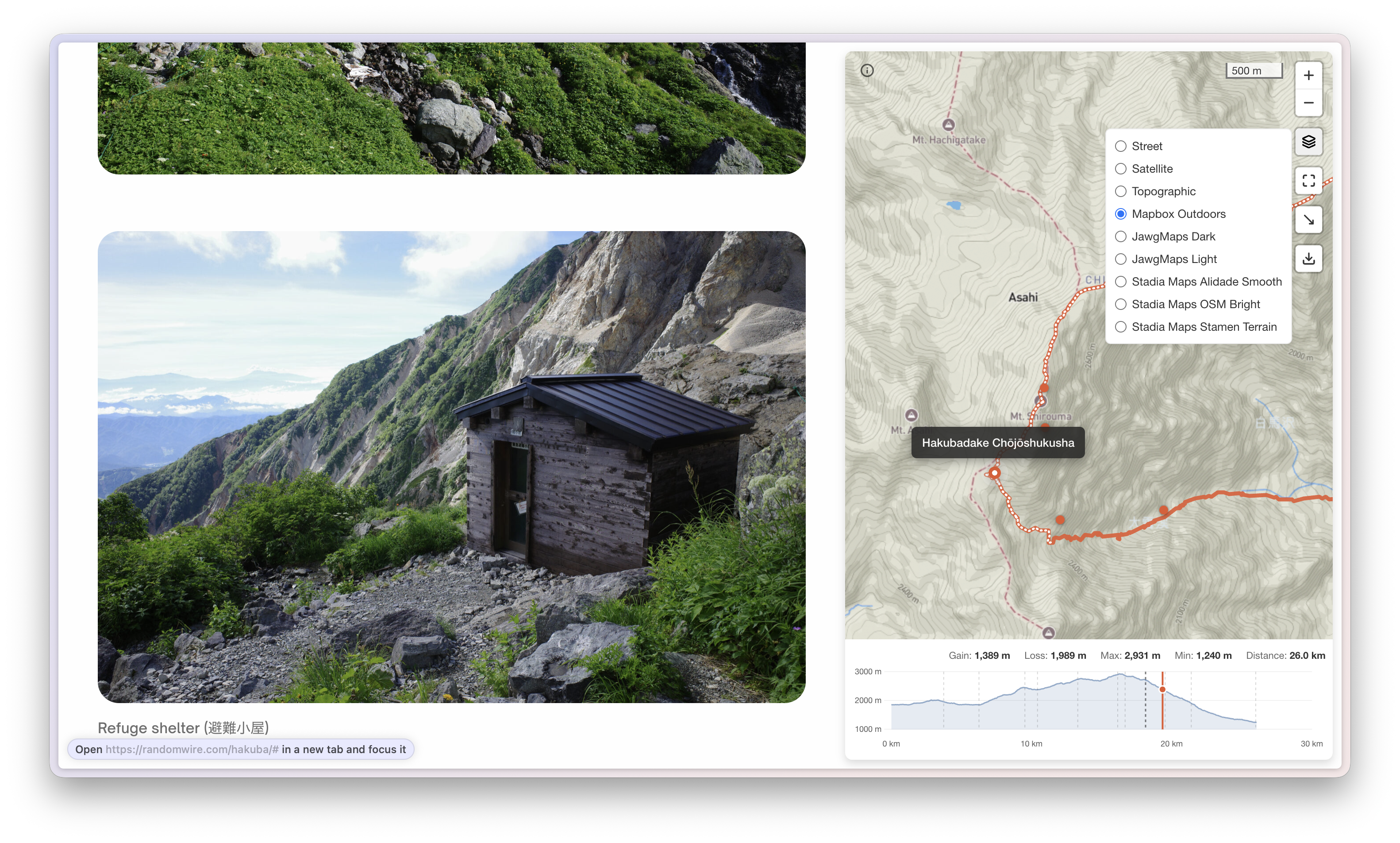
- Street, Satellite, Topographic map styles plus more from other providers (with API keys)
- Fullscreen mode, layer switcher, and optional GPX download for readers
Markers
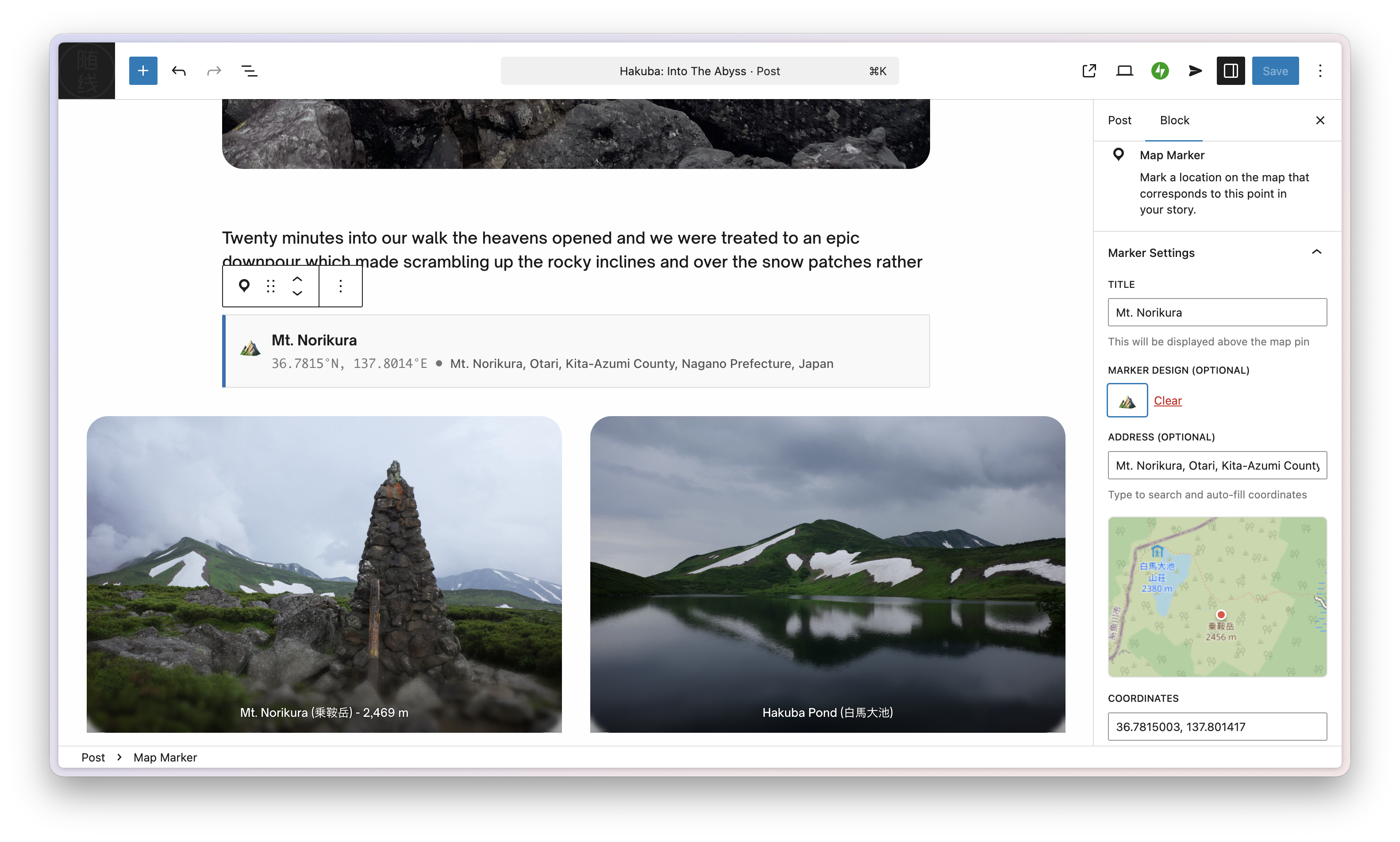
- Place waypoints anywhere in your story with optional emoji pins
- Find locations by address or paste coordinates
- Import named waypoints directly from your GPX file as Map Marker blocks in one click
- Without a GPX file, markers are connected together using a straight line
Layout
- Two-column desktop view: story on the left, sticky map on the right
- Mobile: map sticky at top (hidden by default)
- Readers can dismiss and restore the map at any time
Perfect For
- Hiking and backpacking blogs
- Travel storytelling
- Cycling route documentation
- Race and event recaps
- Historical narratives with geographic context
How It Works
- Create a post and add the Map GPX block
- Upload your GPX file from the media library
- If your GPX contains named waypoints, click Import as Map Markers to add them automatically — or insert Map Marker blocks manually at key points in your story
- Add coordinates and titles to any markers, then arrange them in your story
- Publish – the map automatically follows as readers scroll!
Examples
Compatibility
- Browsers: Chrome 105+, Safari 15.4+
- Themes: Tested on Twenty Twenty-Four and Twenty Twenty-Five. Should work on most block themes. Classic themes are not supported.
Configuring Additional Map Providers (Optional)
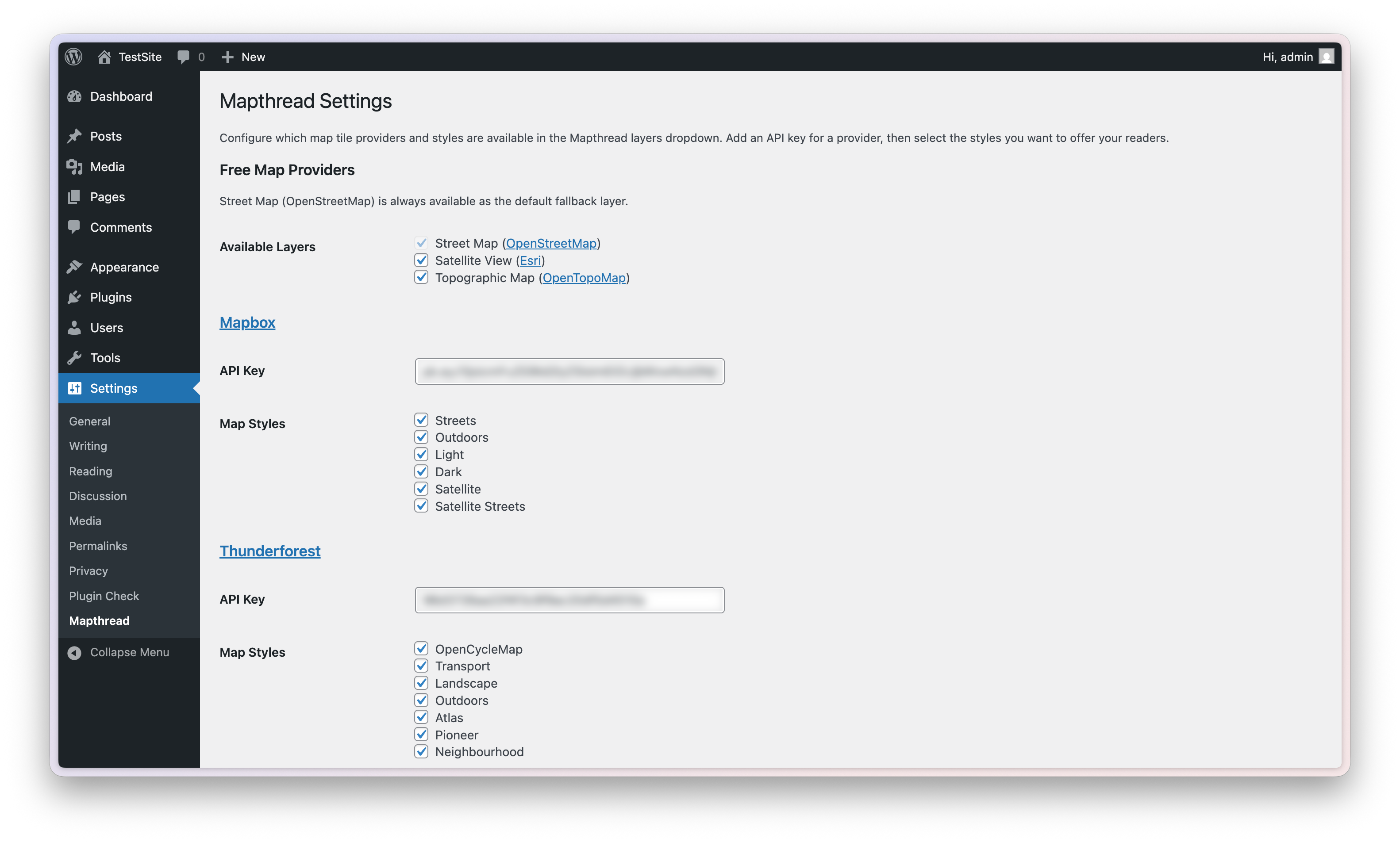
Mapthread includes three free map styles out of the box (Street, Satellite, Topographic). You can also connect additional tile providers with an API key for more map styles: Mapbox, Thunderforest, JawgMaps, Stadia Maps.
- Go to Settings > Mapthread
- Enter your API key for any supported provider (Mapbox, Thunderforest, JawgMaps, Stadia Maps)
- Select which map styles to enable for each provider
- Save Changes — enabled styles will appear in the map layer switcher on the frontend
Frequently asked questions
What is a GPX file?
GPX (GPS Exchange Format) is a standard file format for GPS data. Most hiking apps, fitness trackers, and GPS devices can export GPX files.
Where do I get GPX files?
You can export GPX files from: * Hiking apps (Gaia GPS, AllTrails, etc.) * Fitness apps (Strava, Garmin Connect, etc.) * GPS devices (Garmin, Suunto, etc.) * Google Maps (via Google My Maps)
Can I use multiple GPX files in one post?
Not currently. Only the first Map GPX block per post is used.
How do I get coordinates for markers?
Import from GPX — if your GPX file has named waypoints, click “Import as Map Markers” in the Map GPX block to create markers automatically Use the built-in address search (type any place name) Paste coordinates from Google Maps (right-click a location) Use coordinates from your GPS device or app
Can I import waypoints from my GPX file?
Yes, if your GPX file contains named waypoints ( elements with a tag). After uploading your GPX file, the Map GPX block will show an “Import as Map Markers” button with a count of available waypoints. Clicking it creates Map Marker blocks for all waypoints not already present in the post, inserted immediately after the Map GPX block. Re-clicking is safe — already-imported waypoints are detected by coordinates and skipped.
Does it work with my theme?
Mapthread is designed for block themes. It has not been tested with classic themes.
Is there a file size limit for GPX?
We recommend GPX files under 10MB. Larger files will show a warning and may be slow to render.
Can I customize the map/track/marker colors?
Not currently. But you can set emojis for each Marker instead of the default.
How do I add more map styles?
Go to Settings > Mapthread and enter your API key for any supported provider (Mapbox, Thunderforest, JawgMaps, Stadia Maps). Then select which styles to enable. Each provider offers free tiers suitable for most blogs.
Are API keys secure?
The tile provider API keys used by Mapthread are publishable tokens designed for client-side use. Security is handled via domain restrictions configured in each provider’s dashboard.
Does this work offline?
No, Mapthread requires an internet connection to load map tiles.
Where can I get support?
Post in the plugin support forum or open an issue on GitHub
Can I contribute to the plugin?
Yes! Mapthread is open source — contributions are welcome at github.com/randomwire/Mapthread
What third-party libraries does Mapthread use?
Leaflet.js (BSD-2-Clause) — Interactive map rendering Leaflet.fullscreen (MIT) — Fullscreen map control Chart.js (MIT) — Elevation profile visualization
Does Mapthread connect to any external services?
Yes. Mapthread connects to third-party services to display map tiles, geocode addresses, and look up elevation data. Below is a full description of each service, what data is sent, and when. OpenStreetMap Tile Service Used for: Rendering the default “Street” map layer. When: Every time a visitor views a page containing a Mapthread map, the browser requests tile images from OpenStreetMap servers. Data sent: Tile coordinate requests (zoom level, x/y tile numbers) indicating the geographic area being viewed. The visitor’s IP address is visible to OpenStreetMap servers. Terms of Use | Privacy…
Where can I find the source code?
The compiled JavaScript and CSS files in the build/ directory are generated from human-readable source files. The full source code is available at github.com/randomwire/Mapthread To build from source: 1. Clone the repository 2. Run npm install 3. Run npm run build This uses @wordpress/scripts (webpack) to compile the source files in assets/js/ and assets/css/ into the production build/ directory.
Changelog
Performance update — maps appear faster on cold page loads via resource hints (preconnect, preload) and script defer. Requires WordPress 6.3 or later.
1.6.2 – 2026-05-21
- Performance: Emit
preconnect/dns-prefetchhints in<head>for each map’s tile-server host (Mapbox, Thunderforest, JawgMaps, Stadia Maps, ArcGIS, OpenTopoMap, OpenStreetMap), andpreload as="fetch"for each GPX file URL — downloads and DNS handshakes now overlap with HTML/script parsing instead of running sequentially. - Performance: Use WordPress 6.3+’s
strategy=deferfor the frontend script so it downloads in parallel with HTML parsing. - Changed: Minimum WordPress version raised to 6.3.
1.6.1 – 2026-02-25
- Added: Import named waypoints from GPX as Map Marker blocks — after uploading a GPX file, a button appears in the block editor to instantly create Map Marker blocks from any named
<wpt>elements in the file. Already-imported waypoints are detected by coordinates and skipped to prevent duplicates.
1.6.0 – 2026-02-23
- First official release on the WordPress.org plugin directory
1.5.8 – 2026-02-22
- Added: Source code link added to Description section of readme for immediate visibility to reviewers
- Added: Source repository comment prepended to all compiled JavaScript files via webpack
1.5.7 – 2026-02-21
- Added: Elevation chart crosshair syncs with map track hover — a dashed indicator and dot appear on the elevation profile when hovering over the GPX track, showing elevation at the cursor position
1.5.6 – 2026-02-20
- Improved: External services section reformatted to match WordPress.org scanner expectations — renamed header, added explicit Privacy Policy URLs for every service
- Improved: Third-party libraries separated into dedicated readme section
- Improved: Source code repository link added to plugin Description for reviewer visibility
Screenshots
For developers
Is this your plugin? Show off the numbers.
Add a live badge to your site, docs or GitHub README. It updates on its own — no account needed.
Best Mapthread alternatives
All GPX plugins →




FAQ
Mapthread: quick answers
Straight answers, pulled from live WordPress.org data.
Live data from WordPress.org · checked Oct 1, 2026
Is Mapthread free?
Yes. Mapthread is free to download and use from the official WordPress.org plugin directory.
Is Mapthread safe to use in 2026?
Mapthread works, but test it on a staging site before relying on it in 2026. It runs on 10+ sites and was last updated 4 months ago, and scores 51/100 on our health check.
How many websites use Mapthread?
Mapthread is active on 10+ WordPress websites and has been downloaded 606 times since it launched in February 2026. It was downloaded 75 times in the last 30 days.
Does Mapthread work with WordPress 7.1?
Mapthread is officially tested up to WordPress 7.0.6, while the latest release is 7.1.2. It may still work, but try it on a staging site first.
What PHP version does Mapthread need?
Mapthread requires PHP 7.4 or higher. Most hosts run PHP 8.x today, so it works on any modern WordPress hosting.
When was Mapthread last updated?
The latest version, 1.6.2, was released on May 21, 2026 (4 months ago).
Who makes Mapthread?
Mapthread is developed and maintained by David.
What are the best alternatives to Mapthread?
The most popular alternatives to Mapthread are OSM – OpenStreetMap (10K+ installs), WP GPX Maps (4K+ installs) and Extensions for Leaflet Map (3K+ installs).
Powered by PageForge
Want thousands of pages that rank like these? Build them in an afternoon.
This directory runs on the same engine as PageForge. Turn any spreadsheet, CSV or API into thousands of fast, SEO-ready WordPress pages — with schema, internal links and AI-written copy baked in.
- CSV, Google Sheets & API data sources
- AI content, schema & internal links per page
- Works with Elementor, Gutenberg, Yoast & Rank Math
- Free on WordPress.org — no credit card