

MaxtDesign US Maps
Fast, accessible, zero-footprint interactive vector maps. Build clickable US state and federal-region maps and drop them anywhere.

Mit Vorsicht verwenden
MaxtDesign US Maps works, but test it on a staging site before relying on it in 2026. Was last updated 2 months ago, and scores 60/100 on our health check.
- Getestet mit dem neuesten WordPress (7.1)
- Kleine Benutzerbasis (<10 aktive Installationen)
- Bisher sehr wenige Bewertungen
- Benötigt PHP 8.2 oder neuer
Wie stapelt es sich?
Side-by-side bei Installationen, Updates, Bewertungen und Support


Tägliche Downloads
Download-Spitzen folgen normalerweise einer neuen Version - jede Website, die automatisch aktualisiert wird, gilt als Download.
Ranglisten
Where MaxtDesign US Maps stands todayWordPress.org Ranglisten suchen
Live-Position in der Plugin-Suche, Top 100| Stichwort | Position |
|---|---|
| clickable map | >100 |
| interactive map | >100 |
| states map | >100 |
| svg map | >100 |
| us map | >100 |
About MaxtDesign US Maps
Aus der offiziellen Readme · V1.0.0Beschreibung
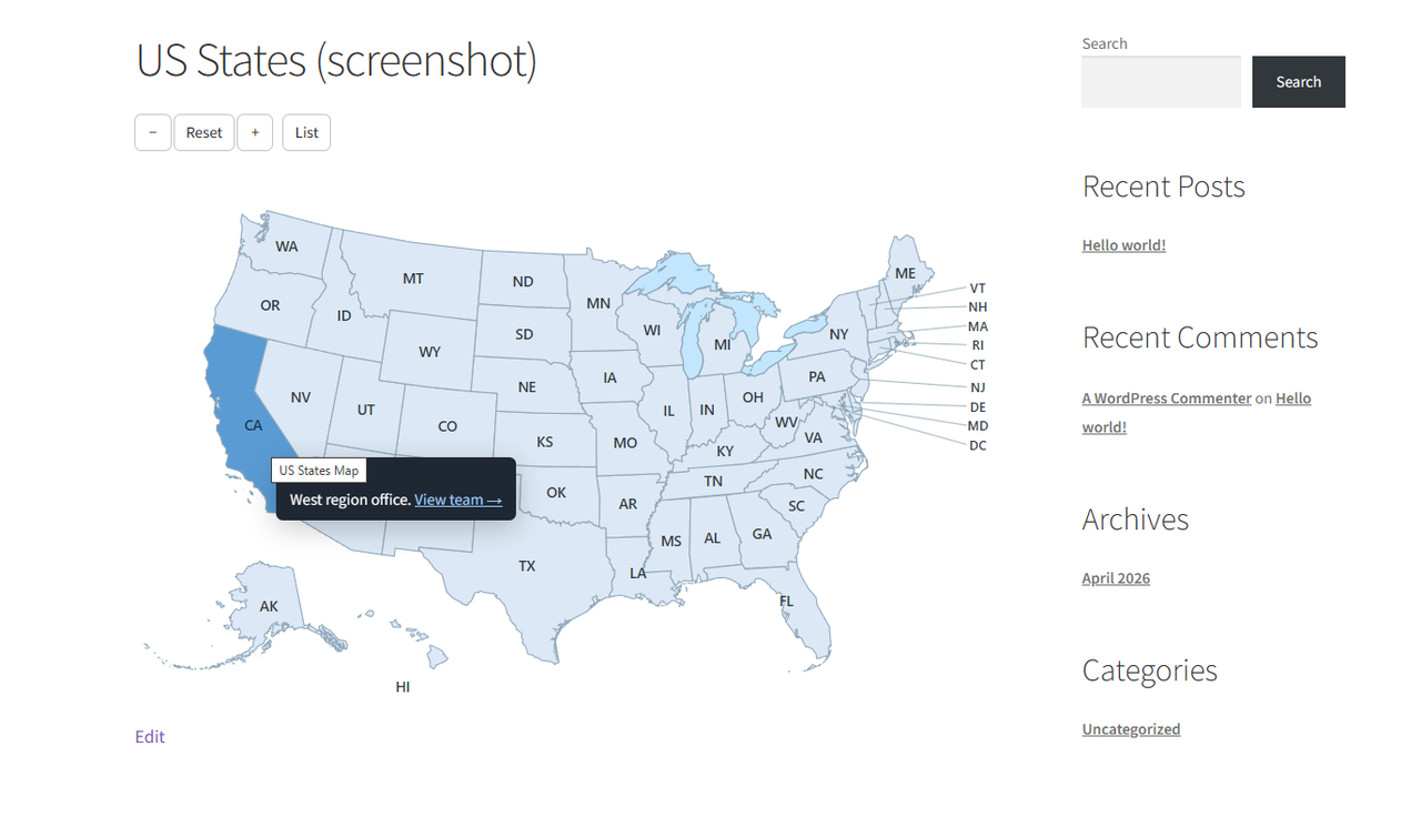
MaxtDesign US Maps renders clickable, fully customizable vector maps with a near-zero front-end footprint: inline SVG, one small deferred script, no jQuery, no web fonts, and no external requests.
Eigenschaften:
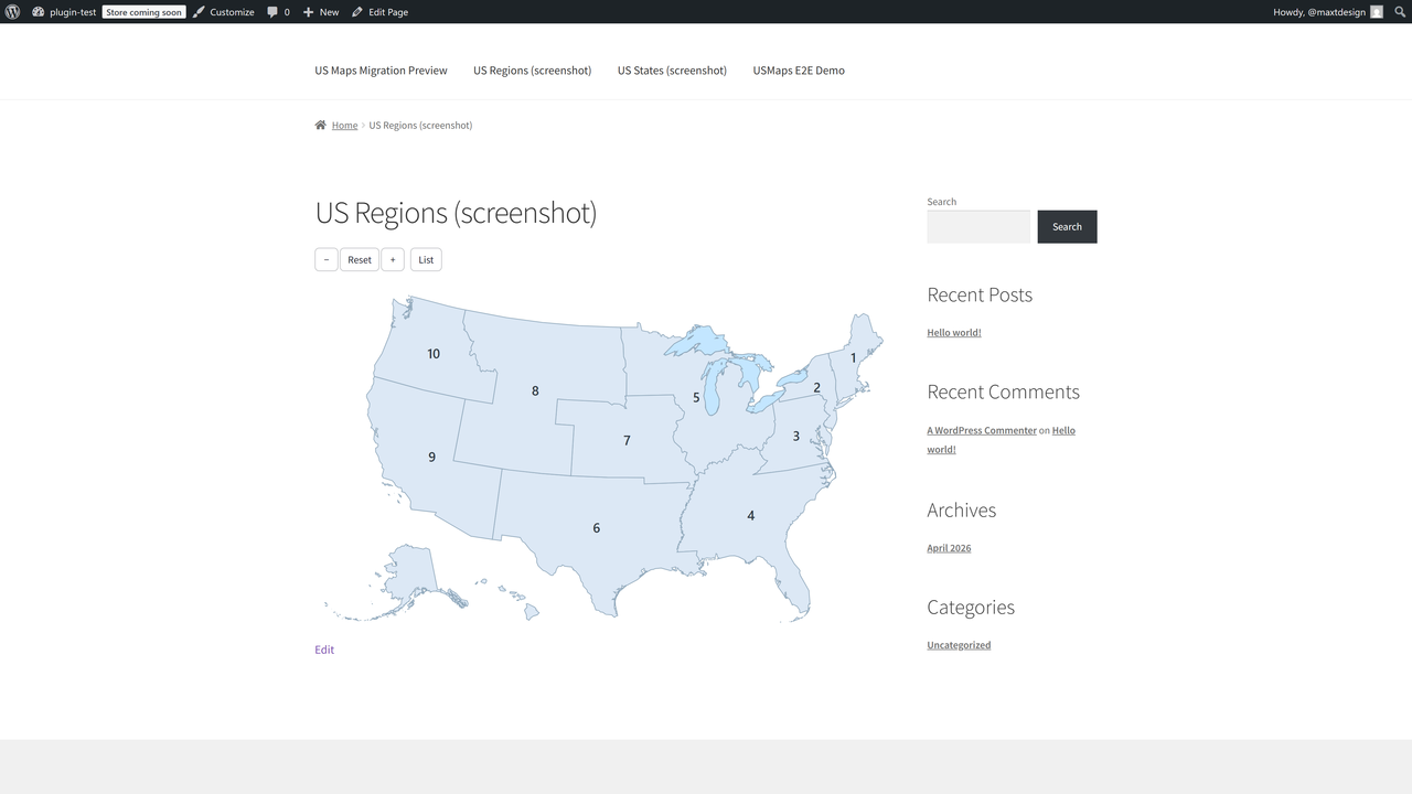
- Two built-in maps: US States (50 + DC) and US Federal Regions (10).
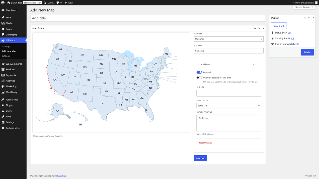
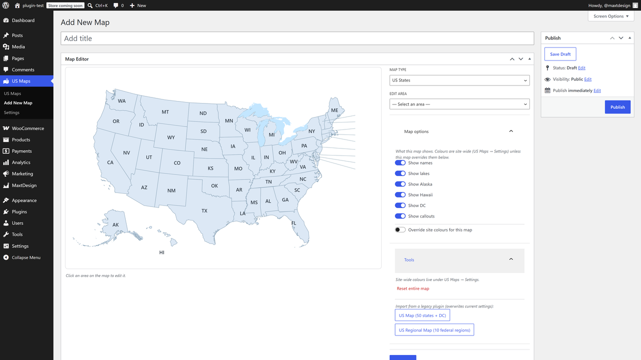
- Customize every area: up / hover / active colors, link, target, tooltip content, enable/disable.
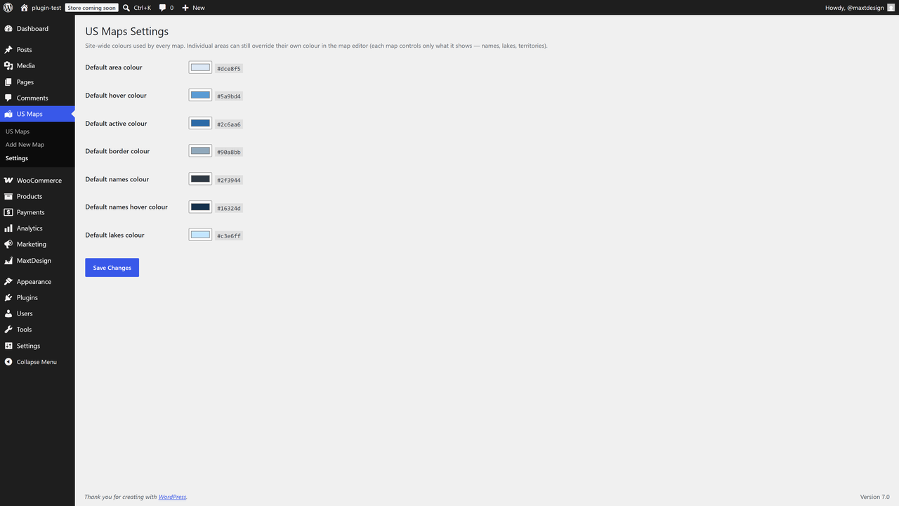
- Global appearance: border, names, lakes, and territory toggles (Alaska, Hawaii, DC, callouts).
- Visual click-to-edit admin built on the WordPress block components.
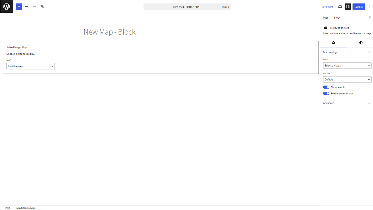
- Unlimited maps per site. Insert with the MaxtDesign Map block or the
[md_usmaps id="123"]shortcode. - Accessible by design: keyboard operable, screen-reader labelled, WCAG 2.2 AA oriented, with a no-JavaScript fallback.
- One-click import from the legacy “US Map” and “US Regional Map” plugins.
Performance
Hover and active colors are pure CSS, so the map is correct on first paint with no JavaScript. The script loads only on pages that actually display a map.
Upgrade to Pro
Need more than states and regions? US Maps Pro builds on this free engine and adds:
- Drill-down / zoom — click a state to open its counties, or a country to open its regions, loaded on demand.
- Premium map packs — every US county, world countries, and US territories.
- Native lightbox — open rich content for any area in an accessible modal.
- Area grouping — combine areas into one unit that shares a colour, link, and tooltip.
- Document attachments — attach Media Library files to an area; they render as download chips in the tooltip and lightbox.
- Automatic updates — delivered straight to your site, licensed and signed.
The free plugin is fully functional on its own; Pro is an optional add-on. Learn more and get Pro: https://maxtdesign.com/plugins/us-maps
Sicherheit
Found a security issue? Please report it privately to security@maxtdesign.com rather than posting
in a public support thread. We aim to acknowledge reports within 3 business days and will agree a
disclosure timeline with you.
Please include the plugin version, steps to reproduce, and the impact as you understand it. We will
credit you in the changelog unless you would rather stay anonymous, and we ask that you do not test
against a site you do not own.
This plugin is published on WordPress.org by the account slaacr, which is MaxtDesign. The account
name predates the brand and WordPress.org does not support renaming accounts, so the two names
differ. Anything published under slaacr is ours.
Installation
- Upload the plugin to
/wp-content/plugins/maxtdesign-usmaps, or install it from the Plugins screen. - Activate it.
- Open US Maps → Add Map, configure your map, and publish.
- Add it to a page with the MaxtDesign Map block or the
[md_usmaps id="123"]shortcode.
Änderungsprotokoll
Erste Veröffentlichung.
1.0.0
- Initial release: US States + US Federal Regions packs, visual editor, block + shortcode, legacy importer, full accessibility, zero-footprint front end.
- Auto-import on activation: existing legacy maps are imported into their own map automatically (once, idempotently), seeding the global palette from the old map’s colours.
Screenshots
Für Entwickler
Ist das dein Plugin? Zeigen Sie die Zahlen.
Fügen Sie Ihrer Website, Docs oder GitHub Readme ein Live-Badge hinzu. Es wird von selbst aktualisiert - kein Konto erforderlich.
Best MaxtDesign US Maps alternatives
All clickable map plugins →


Fragen und Antworten
MaxtDesign US Maps: quick answers
Gerade Antworten, gezogen von Live WordPress.org Daten.
Quelle: WordPress.org
Is MaxtDesign US Maps free?
Yes. MaxtDesign US Maps is free to download and use from the official WordPress.org plugin directory.
Is MaxtDesign US Maps safe to use in 2026?
MaxtDesign US Maps works, but test it on a staging site before relying on it in 2026. Was last updated 2 months ago, and scores 60/100 on our health check.
How many websites use MaxtDesign US Maps?
MaxtDesign US Maps is active on <10 WordPress websites and has been downloaded 351 times since it launched in June 2026. It was downloaded 78 times in the last 30 days.
Does MaxtDesign US Maps work with WordPress 7.1?
Yes. The developer has tested MaxtDesign US Maps up to WordPress 7.1.5, the latest release. It requires WordPress 6.4 or newer.
What PHP version does MaxtDesign US Maps need?
MaxtDesign US Maps requires PHP 8.2 or higher. Most hosts run PHP 8.x today, so it works on any modern WordPress hosting.
When was MaxtDesign US Maps last updated?
The latest version, 1.0.0, was released on September 14, 2026 (2 months ago).
Who makes MaxtDesign US Maps?
MaxtDesign US Maps is developed and maintained by MaxtDesign.
What are the best alternatives to MaxtDesign US Maps?
The most popular alternatives to MaxtDesign US Maps are HTML5 Maps (4K+ installs), Interactive World Map (900+ installs) and SimpleMaps (600+ installs).
Angetrieben von PageForge
Eine Vorlage und eine Tabelle. Eine echte Seite für jede Suche.
PageForge Verwandelt jede Zeile eines CSV in eine WordPress-Seite mit eigenem Titel, URL, SEO Felder und Schema entworfen. Kostenlos auf WordPress.org.
- CSV und XLSX, plus Google Sheets auf Beruf und Unternehmen
- seinen eigenen Titel, URL, SEO Felder und Schema für jede Seite
- Arbeitet mit dem Blockeditor, Elementor, Divi und Avada
- Kostenlos auf WordPress.org, keine Kreditkarte