

Lf Hiker
Lf Hiker is a plugin for quickly display your gpx tracks with their profile elevation on an interactive map.

Considere uma alternativa
Lf Hiker shows warning signs in 2026 — compare the alternatives below before installing. It runs on 200+ sites, is rated 5/5 and was last updated 8 years ago, and scores 38/100 on our health check.
- Pequena base de usuários (mais de 200 instalações ativas)
- Nenhuma atualização em 8 anos
- Testado apenas até WordPress 4.9 (mais recente é 7.1)
Como ele se acumula?
Lado a lado em instalações, atualizações, avaliações e suporte

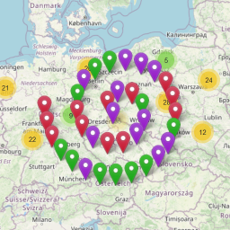

Downloads diários
Os picos de download geralmente seguem uma nova versão — cada site que atualiza automaticamente é um download.
Rankings
Where Lf Hiker stands todayWordPress.org Classificações de pesquisa
Posição ao vivo na pesquisa de plugins, top 100| Palavra chave | Posição |
|---|---|
| GPX | #50 |
| hiker | #3 |
| map | >100 |
| runner | >100 |
| track | >100 |
Adoção da versão
Compartilhamento de sites ativos por lançamento.
Divisão de classificação
★★★★★ ★★★★★ 5 de 6 comentários
About Lf Hiker
From the official readme · v1.13.0Descrição
Lf Hiker is a plugin for quickly display your gpx tracks with their profile elevation on an interactive map.
Lf Hiker is responsive and mobile friendly.
Main Utilisation
Simply upload your gpx file with the wordpress media manager, complete its informations and insert it in your post/page (shortcode).
[lfh-gpx src=url_to_file.gpx color=darkgreen width=6]A trail in Cevennes[/lfh-gpx]
Display the post/page : you have an interactive view of your track.
The trail is displayed on an OSM map by default, and have its own information window with:
- title
- description
- interactive profile elevation according to path
- distance of the track
- maximum elevation
- minimum elevation
- elevation loss
- elevation gain
- trail duration
- download link of gpx file
For more information go to Lf Hiker site
Usar
-
Serviços
- OpenStreetMap an open map of the world
- Maps Stamen design map
- OpenTopoMap topographic map
- ArcGIS topographic map
-
Libraries
- leaflet an open-source JavaScript library for mobile-friendly interactive maps
- leaflet-gpx a leaflet plugin for the analysis and parsing of a GPX track
- font-awesome for iconic font
- fontello for iconic font
- awesome-marker Colorful, iconic markers by Lennard Voogdt
- Shortcode Empty Paragraph little worpress plugin fix issue shortcode by Johann Heyne
List of Features
Lf Hiker allows displaying too:
- few gpx files in the same map
- markers on the map
- few maps on the same post/page
For gpx track you can custom:
- title
- description
- stroke color
- stroke width
- display button download gpx file
And only in shortcode:- the elevation unit
- the distance unit
- the minimum step on elevation axis (in meter)
Lf Hiker included an helper for edit map and add markers.
You can choose
for the map:
- the tiles layer ( among OSM, OSM_FR , stamen watercolor, arcgis world topo, mapquest with api key)
- to display the fullscreen button
- the map’s view or let lf Hiker find automatically the best view
- to display the reset button
- to display the button “list of layers”
- the size of the map
- classnames for the map ( including your custom class)
- to zoom on mousewheel
- to start with profile elevation displayed
- to display the description always under the map
for the markers:
- color of icon marker
- symbol in the icon
- title
- popup
- visibility according to zoom or not
- independant window with large description
You can do all this with the helpers or directly using shortcodes
You can choose to unactive the helper.
Lf Hiker allows you to customize the css in admin configuration (colors of information window, buttons and selected path)
IMPORTANT
If you think you found a bug in Lf Hiker or have any problem/question concerning the plugin, do not hesitate to contact me.
Supported languages
- Français (fr_FR)
- English (en_US)
- Deutsch (de_DE) by Kristof Kling
- Greek (el) by Pol Gkitsas
- Dutch (nl-BE)
-
Spanish (es-ES) by Miguel Angel
If you need language of Lf Hiker which is not included. You can easily translate with poedit from the file :
lf-hiker/languages/lfh-default.po.I will be happy, to add your translation to Lf Hiker.
If you have any questions about the method, do not hesitate to contact me.
If you find errors in my english translation do not hesitate to contact me.
Minimum requirements
- WordPress 4.7.x
- PHP 5.6
- MySQL 5.x
Instalação
From Plugins Page
- Log in to the administrator panel.
- Go to Plugins Tab
- Click on Add New button
- Type hiker in the search field
- When you found lf-hiker click Install button for upload the plugin on your server
- Click Activate button for activate Lf Hiker.
- You can change the default configuration in tab:
Settings → Lf-hiker
If installation failed, do not hesitate to contact me.
From zip archive
- Unzip
lf-hiker.zip - Put the folder
lf-hikerin directorywp-content/plugins - Log in to the administrator panel.
- Go to Plugins Tab: Lf Hiker is among the plugins
- Click
Activatebutton for activate Lf Hiker. - If the activation does not succeed, please contact me.
- You can change the default configuration in tab:
Settings → Lf-hiker
Log de Changes
For more informations see lf Hiker
1.13.0
- Evolution: add spanish language
1.12.0
- Evolution: add empty marker
- Evolution: add dutch language
- Fixed: error twice class for label in profile svg
1.11.0
- Evolution: Ability to always display the caption under the map
- Evolution: Helper – Ability to add marker with its coordinates
- Evolution: Add greek translation
- Fixed: duration is not displayed
- Fixed: choose center and zoom is not working
1.10.0
- Fixed: lf hiker is destroying the AMP pages
- Fixed: bug with tabby-responsive-tabs plugin
- Evolution: gpx buttons are ordered in list as the gpx files in post/page
- Evolution: Ability to choose the leaflet host
1.9.0
- Fixed: trouble position of gpx dom block, marker block and list block
- Fixed: trouble with map when tabs (map only on top left corner)
- Evolution: Add open Topo Map tiles
1.8.1
- Fixed: no icon for way point
Capturas de tela


Para desenvolvedores
Este é o seu plugin? Mostre os números.
Adicione um crachá ao vivo ao seu site, Documentos ou Readme do GitHub. Ele é atualizado por conta própria - nenhuma conta necessária.
Best Lf Hiker alternatives
All GPX plugins →





FAQ
Lf Hiker: quick answers
Respostas diretas, extraídas de dados ao vivo WordPress.org.
Fonte: WordPress.org
Is Lf Hiker free?
Yes. Lf Hiker is free to download and use from the official WordPress.org plugin directory.
Is Lf Hiker safe to use in 2026?
Lf Hiker shows warning signs in 2026 — compare the alternatives below before installing. It runs on 200+ sites, is rated 5/5 and was last updated 8 years ago, and scores 38/100 on our health check.
How many websites use Lf Hiker?
Lf Hiker is active on 200+ WordPress websites and has been downloaded 17,933 times since it launched in May 2017. It was downloaded 297 times in the last 30 days.
Does Lf Hiker work with WordPress 7.1?
Lf Hiker is officially tested up to WordPress 4.9.36, while the latest release is 7.1.5. It may still work, but try it on a staging site first.
When was Lf Hiker last updated?
The latest version, 1.13.0, was released on September 30, 2018 (8 years ago).
Who makes Lf Hiker?
Lf Hiker is developed and maintained by Elisabeth Pointal.
What are the best alternatives to Lf Hiker?
The most popular alternatives to Lf Hiker are OSM – OpenStreetMap (10K+ installs), WP GPX Maps (4K+ installs) and Extensions for Leaflet Map (3K+ installs).
Alimentado por PageForge
Um modelo e uma planilha. Uma página real para cada pesquisa.
PageForge Transforma cada linha de um CSV em uma página WordPress com seu próprio título, URL, SEO campos e esquema, construído no layout que você já desenhou. Gratuito em WordPress.org.
- CSV e XLSX, mais Google Sheets em Profissional e Empresarial
- Seu próprio título, URL, SEO campos e esquema para cada página
- Funciona com o editor de blocos, Elementor, Divi e Avada
- Gratuito em WordPress.org, sem cartão de crédito